From Central London: 2.4 miles (3.9 km)
nearest
Tube Station: Earl"s Court 0.4 miles (0.7 km)
Railway Station: West Brompton 0.6 miles (1.0 km)
Motorway: M4 Junction 1, 4.0 miles (6.5 km)
Hold down your left mouse button down while clicking on the map, keep it held down to move the map around.
Use the + and - symbols on the maps left bar to zoom in and out..
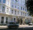
Click an icon to view hotel information
Directions:
By Car
From London Heathrow (30-60 minutes)turn right at traffic lights by Cromwell
Hospital into Knaresborough Place, then left (follow road round corner) after 2
blocks into Courtfield Road and then right onto Ashburn Place. Hotel is located
on the right of the small roundabout. The doorman can valet park your car to the
nearest public car park (at a charge), no need to book.
By Underground
Heathrow Airport; by underground direct to Gloucester Road station on the
Piccadilly Line, 45 minutes. At the exit, turn right onto Gloucester road and
right at the traffic lights onto Harrington Gardens, the hotel is on the left.
By Train
Heathrow to Paddington Station, 20 minutes on the Heathrow Express Train (2-4
trains per hour) Gatwick to Victoria Station, 30 minutes by Gatwick Express
Train (2-4 trains per hour) Take Underground to Gloucester Road Tube Station
or 15 minutes taxi ride.
 From Central London: 2.4 miles (3.9 km)