milesfaster.co.uk - London Website
Home London Hotels A-Z UK Hotels Theatre/event packages/offers London Olympics 2012 London Guide/Pictures Contact Us
Search London By: London Airports Postcode Landmark/Area London Hotels Map Train/Tube Station Star Rating Cheap/Budget London Chains

Queens hotel Map


Queens Hotel From Central London: 6.9 miles (11.1 km)
nearest:
Station: Crystal Palace 0.4 miles (0.7 km)
Motorway Junction: M23 Jnct 7: 9.8 miles (15.8 km)


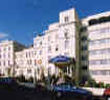
Address: 122 Church Road, Crystal Palace, Croydon, London, SE19 2UG, England, UK

>>>BACK TO QUEENS HOTEL PAGE

Hold down your left mouse button down while clicking on the map, keep it held down to move the map around.
Your scroll button will zoom the map when your mouse pointer is over the map
Click an icon to view hotel information

Street View Location is approximate, click on the image and hold your mouse down to drag view

Directions:
1) From Heathrow Underground: Take the Piccadilly Line (Eastbound) to South Kensington Underground Station. Change and take the Circle Line or the District Line (Eastbound, Platform 2) to London Victoria. ~
2) From Victoria Station: Take the train to 'Crystal Palace' rail station. The hotel is at 10 minutes walking distance or 4 minutes by taxi from the station.
3) From Gatwick Airport: Take the Gatwick Express and go to Clapham Junction. This takes about 20 minutes. From there, take the Train towards to Crystal Palace Train Station. The hotel is at 10 minutes walking distance or 4 minutes by taxi from the station.


>>>BACK TO QUEENS HOTEL PAGE

Privacy Policy
Copyright © 2002-2012 Milesfaster.co.uk All Rights Reserved