milesfaster.co.uk - London Website
Home London Hotels A-Z UK Hotels Theatre/event packages/offers London Olympics 2012 London Guide/Pictures Contact Us
Search London By: London Airports Postcode Landmark/Area London Hotels Map Train/Tube Station Star Rating Cheap/Budget London Chains

Travelodge Wembley Map


Travelodge Wembley From Central London: 6.6 miles (10.7 km)
nearest
Tube Station: Park Royal 0.7 miles (1.1 km)
Train Station: Stonebridge Park 0.5 miles (0.8 km)
Motorway Junction: M4 junction 1: 3.4 miles (5.5 km)

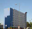
Address: Northdale House, North Circular Road, Ealing, London, NW10 7UG

>>>BACK TO TRAVELODGE WEMBLEY PAGE

Hold down your left mouse button down while clicking on the map, keep it held down to move the map around.
Your scroll button will zoom the map when your mouse pointer is over the map
Click an icon to view hotel information

Street View Location is approximate, click on the image and hold your mouse down to drag view

Directions:
From the M40/A40 - exit A40 at Hanger Lane Gyratory. Take the 2nd exit at the roundabout signposted A406 North. Keep left & take the 1st slip road on the left (signposted Abbeydale Industrial Estate) at the junction bear right, the hotel is located approximately 400 yards on the left hand side. From the M4 - leave at Junction 1 (Chiswick). Take the 2nd exit off the roundabout A406 North Circular. Travel approximately 2 1/2 miles to Hanger Lane Gyratory. Take the 3rd exit signposted A406 North. Keep left & take the 1st slip road on the left. At the junction turn right, the hotel is located 400 yards on the left hand side.


>>>BACK TO TRAVELODGE WEMBLEY PAGE

Privacy Policy
Copyright © 2002-2012 Milesfaster.co.uk All Rights Reserved