From Central London: 1.1 miles (1.7 km)
nearest
Tube Station: Victoria 0.4 miles (0.6 km)
Railway Station: London Victoria 0.4 miles (0.6 km)
Motorway: M4 Junction 1, 6.1 miles (9.8 km)
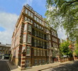
Address: 69 Vincent Square, London, England, UK, SW1P 2PA
Hold down your left mouse button down while clicking on the map, keep it held down to move the map around.
Use the + and - symbols on the maps left bar to zoom in and out..
Click an icon to view hotel information
Directions: Underground: Underground station is Victoria or St. James Park, which are only 10/11 minutes walk.
Rail: Euston, Kings Cross St. Pancras, Euro-Star trains to Paris and Brussels from Waterloos.
Air: Heathrow Airport is 50 minutes away by car or taxi. Gatwick airport is 30 miles away by car or taxi. At Victoria and Paddington mainline stations there are express services to Gatwick and Heathrow Airport respectively.
Parking: The National car park in Rochester Row, which is just a minute from the hotel.
 From Central London: 1.1 miles (1.7 km)