Holiday Inn Bloomsbury map


Holiday Inn Bloomsbury From Central London: 1.1 miles (1.7 km)
nearest
Tube Station: Russell Square 0.1 miles (0.1 km)
Railway Station: London St Pancras Domestic 0.5 miles (0.8 km)
Motorway: M1 Junction 1, 5.6 miles (9.0 km)

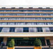
Address: Coram Street, London, England, UK, WC1N 1HT

Hold down your left mouse button down while clicking on the map, keep it held down to move the map around. Use the + and - symbols on the maps left bar to zoom in and out.. Click an icon to view hotel information

>>>BACK TO HOLIDAY INN BLOOMSBURY PAGE

SHOW NEXT NEAREST HOTELS:  1-10:  11-20:   21-30:   31-40:   41-50:    


Directions: M40-A40 TO MARLEYBONE RD, GO TO EUSTON RD. RIGHT OPPOSITE EUSTON STATION TO UPPER WOBURN ST. 2ND LEFT TO CORAM ST, HTL ON RIGHT. M1-A41 GO TO REGENT PARK. RIGHT ON MARLEYBONE RD, GO TO EUSTON RD. RIGHT OPPOSITE EUSTON STATION. FOLLOW ABOVE DIRECTIONS.

>>>BACK TO HOLIDAY INN BLOOMSBURY PAGE

Privacy Policy
Copyright © 2021 Milesfaster.co.uk All Rights Reserved