Main Index
London Hotels A-Z
London Airport Hotels
UK Hotels
Theatre/event packages
London Olympics
London Guide/Pictures
Contact Us
View All London Hotels on a Map
Park Inn Russell Square Map
nearest
Tube Station: Holborn 0.2 miles (0.3 km)
Railway Station: Farringdon 0.7 miles (1.1 km)
Motorway Junction: M1 junction 1: 5.7 miles (9.2 km)
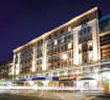
Address: 92 Southampton Row, London, WC1B 4BH
>>>
BACK TO PARK INN RUSSELL SQUARE PAGE
Hold down your left mouse button down while clicking on the map, keep it held down to move the map around.
Your scroll button will zoom the map when your mouse pointer is over the map
Click an icon to view hotel information
JavaScript must be enabled in order for you to use Google Maps.
However, it seems JavaScript is either disabled or not supported by your browser. To view Google Maps, enable JavaScript by changing your browser options, and then try again.
>>>
BACK TO PARK INN RUSSELL SQUARE PAGE
Copyright © 2002-2008 Milesfaster.co.uk All Rights Reserved