Citadines Holborn Covent Garden map


Citadines Holborn Covent Garden From Central London: 0.9 miles (1.4 km)
nearest
Tube Station: Holborn 0.1 miles (0.2 km)
Railway Station: Farringdon 0.6 miles (1.0 km)
Motorway: M1 Junction 1, 6.0 miles (9.7 km)

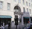
Address: 94-99 High Holborn, London, England, UK, WC1V 6LF

Hold down your left mouse button down while clicking on the map, keep it held down to move the map around. Use the + and - symbols on the maps left bar to zoom in and out.. Click an icon to view hotel information

>>>BACK TO CITADINES HOLBORN COVENT GARDEN PAGE

SHOW NEXT NEAREST HOTELS:  1-10:  11-20:   21-30:   31-40:   41-50:    


>>>BACK TO CITADINES HOLBORN COVENT GARDEN PAGE

Privacy Policy
Copyright © 2021 Milesfaster.co.uk All Rights Reserved