From Central London: 4.9 miles (7.9 km)
nearest
Tube Station: Bow Road 0.0 miles (0.0 km)
Railway Station: Hackney Wick 1.1 miles (1.8 km)
DLR Station: Bow Church 0.2 miles (0.3 km)
Motorway: M11 Junction 4, 5.4 miles (8.7 km)
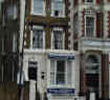
Address: 94 Bow Road, London, E3 3AA, England, UK
Hold down your left mouse button down while clicking on the map, keep it held down to move the map around.
Use the + and - symbols on the maps left bar to zoom in and out..
Click an icon to view hotel information
Directions: By Public Transport:
District and Central lines can be accessed from Bow Road station, which is within 5 minutes walk. Bow Church (for the DLR) is just steps away, giving you easy access to London Excel, City Airport and the Royal Docks. London buses are also available right opposite to the hotel, going into the City, Tower of London, Tower Bridge and the West End.
By Car:
CityStay Hotel is outside the congestion charge zone. Bow Road (A11) provides access to both the A12 and A13.
 From Central London: 4.9 miles (7.9 km)