Ibis Wembley map


Ibis Wembley From Central London: 7.2 miles (11.6 km)
nearest
Tube Station: Wembley Central 0.6 miles (0.9 km)
Railway Station: Wembley Stadium 0.1 miles (0.2 km)
Motorway: M1 Junction 1, 2.7 miles (4.3 km)

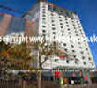
Address: South Way, Wembley, London, England, UK, HA9 6BA

Hold down your left mouse button down while clicking on the map, keep it held down to move the map around. Use the + and - symbols on the maps left bar to zoom in and out.. Click an icon to view hotel information

>>>BACK TO IBIS WEMBLEY PAGE

SHOW NEXT NEAREST HOTELS:  1-10:  11-20:   21-30:   31-40:   41-50:    


Directions: From M1 at the end of the motorway take the South Circular Road (A406). Exit onto A404 signposted Wembley and follow road for 1 mile. At traffic lights with Wembley Hill Road turn right and then 1st right into South Way. From M40 and central London join the North Circular Road (A406) at Hanger Lane junction. Exit onto A404 signposted Wembley and follow road for 1 mile. At traffic lights with Wembley Hill Road turn right and then 1st right into South Way.

>>>BACK TO IBIS WEMBLEY PAGE

Privacy Policy
Copyright © 2021 Milesfaster.co.uk All Rights Reserved