My Bloomsbury map


Myhotel Bloomsbury From Central London: 0.6 miles (1.0 km)
nearest
Tube Station: Tottenham Court Road 0.2 miles (0.3 km)
Railway Station: London Euston 0.7 miles (1.1 km)
Motorway: M1 Junction 1, 5.6 miles (8.9 km)

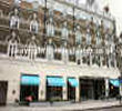
Address: 11-13 Bayley Street, London, England, UK, WC1B 3HD

Hold down your left mouse button down while clicking on the map, keep it held down to move the map around. Use the + and - symbols on the maps left bar to zoom in and out.. Click an icon to view hotel information

>>>BACK TO MY BLOOMSBURY PAGE

SHOW NEXT NEAREST HOTELS:  1-10:  11-20:   21-30:   31-40:   41-50:    


Directions:
myhotel Bloomsbury is less than a 5-minute walk from Tottenham Court Road tube station. This station is serviced by both the Northern and the Central Lines.
Goodge Street is very close too - Goodge Street is on the Northern Line.

Distance from London City Airport: 9.57 miles / 15.4 km

Distance from London Heathrow Airport: 19.05 miles / 30.6 km
Take the Piccadilly Line to Leicester Square Station and change to the Northern Line (Northbound) to Tottenham Court Road Station (1 stop).

Distance from Stansted Airport:
Take the Express rail service to Liverpool Street Station, then the underground Central Line (Westbound) to Tottenham Court Road Station (5 stops).

Distance from London Victoria Station: 2.7 miles / 4.3 km
Take the underground Victoria line (Northbound) to Oxford Circus (2 stops), then change onto the Central Line (Eastbound) to Tottenham Court Road Station (1 stop).

Distance from London Waterloo International Station: 2.38 miles / 3.8 km
Take the underground Northern Line (Northbound Charing Cross branch) to Tottenham Court Road Station (2 stops).

Distance from Euston Station: 1 mile / 1.6 km
Take the underground Northern line (Southbound Charing Cross branch) to Tottenham Court Road Station (3 stops).

Distance from London Paddington Station: 2.42 miles / 3.9 km

>>>BACK TO MY BLOOMSBURY PAGE

Privacy Policy
Copyright © 2021 Milesfaster.co.uk All Rights Reserved