 From Central London: 11.8 miles (19.0 km)
 nearest
Tube Station: High Barnet 3.1 miles (5.0 km)
Railway Station: Elstree & Borehamwood 0.8 miles (1.3 km)
Motorway: M1 Junction 4, 2.3 miles (3.7 km)
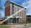
Address: Elstree Way, Borehamwood, Greater London, England, UK, WD6 1JY