milesfaster.co.uk - London Website
Home London Hotels A-Z UK Hotels Theatre/event packages/offers London Olympics 2012 London Guide/Pictures Contact Us
Search London By: London Airports Postcode Landmark/Area London Hotels Map Train/Tube Station Star Rating Cheap/Budget London Chains

Marriott Regents Park Map


MARRIOTT LONDON REGENTS PARK From Central London: 2.7 miles (4.4 km)
nearest:
Tube Station: Swiss Cottage 0.2 miles (0.3 km)
Train Station: South Hampstead 0.4 miles (0.6 km)
Motorway Junction: M1 junction 1: 4.4 miles (7.1 km)

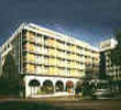
Address: 128 King Henry's Road, London,UK,NW3 3ST

>>>BACK TO MARRIOTT REGENTS PARK PAGE

Hold down your left mouse button down while clicking on the map, keep it held down to move the map around.
Your scroll button will zoom the map when your mouse pointer is over the map
Click an icon to view hotel information

Street View Location is approximate, click on the image and hold your mouse down to drag view

Directions: At Heathrow Airport Roundabout take the 2nd exit onto Airport Way. At Airport Roundabout take the 1st exit onto the A505. At Roundabout take the 1st exit onto the 1081. Join the M1, continue forward and merge on to the A406. At Brent Cross Interchange branch left, then at Roundabout take the 3rd exit onto unnamed road. Continue forward and merge onto A41. At Swiss Cottage, traffic signals continue forward. At traffic signals turn left onto Adelaide Road. Take the 1st right on Adelaide Road onto King Henry's Road. The hotel is on the left.


>>>BACK TO MARRIOTT REGENTS PARK PAGE

Privacy Policy
Copyright © 2002-2012 Milesfaster.co.uk All Rights Reserved