From Central London: 1.6 miles (2.5 km)
nearest
Tube Station: Southwark 0.3 miles (0.4 km)
Railway Station: London Waterloo East 0.4 miles (0.6 km)
DLR Station: Tower Gateway 1.2 miles (1.9 km)
Motorway: M1 Junction 1, 7.2 miles (11.7 km)
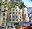
Address: 71-79 Southwark Street, London, SE1 0JA, England, UK
Hold down your left mouse button down while clicking on the map, keep it held down to move the map around.
Use the + and - symbols on the maps left bar to zoom in and out..
Click an icon to view hotel information
Directions:
Via the M1 follow signs for CENTRAL LONDON, M1 and then NORTH CIRCULAR RD WEST, M4. Continue to Staples Crnr then turn left at the next roundabout. Turn to Staples Corner W, then Edgware Rd, then to Marylebone Rd. Continue on Euston Rd, follow the roadright, turn right onto Kings Cross Rd and continue on Farringdon Rd. Cross Blackfriars Bridge over the Thames, turn left onto Southwark St, take the 2nd street on the right into Great Suffolk St and then left into Lavington St. The hotel is on the left.
Coming by
tube you need to take the Jubilee line towards
London Bridge or
Southwark Station. These stations are a 5-10 minute walk from the hotel.