milesfaster.co.uk - London Website
Home London Hotels A-Z UK Hotels Theatre/event packages/offers London Olympics 2012 London Guide/Pictures Contact Us

Search London By: Postcode Landmark/Area London Hotels Map Train/Tube Station Star Rating Cheap/Budget London Chains
Select Airport Gatwick Heathrow Luton Stansted London City Airport
Holiday Inn Express Stratford Map

NEWHAM HOTEL From Central London: 7.5 miles (12.1 km)
nearest:
Tube Station: Upton Park 0.9 miles (1.4 km)
Railway Station: Forest Gate 0.3 miles (0.5 km)
Motorway Junction: M11 Jnct 4: 3.2 miles (5.1 km)

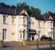
Address: 349 Romford Road, London, England, UK, E7 8AA

>>>BACK TO NEWHAM HOTEL PAGE

Hold down your left mouse button down while clicking on the map, keep it held down to move the map around.
Your scroll button will zoom the map when your mouse pointer is over the map
Click an icon to view hotel information

Street View Location is approximate, click on the image and hold your mouse down to drag view

Directions:
By Car
The Newham Hotel is in Forest Gate on the main road (A118) into London, 2 miles from Ilford and the North Circular road (A406).
By Public Transport
The hotel is 5 minutes' walk from Forest Gate Station, which is 3 minutes by train from Stratford East and 13 minutes from Liverpool Street.


>>>BACK TO NEWHAM HOTEL PAGE

Copyright © 2002-2010 Milesfaster.co.uk All Rights Reserved