Waldorf Hilton Hotel - London map


Waldorf Hilton Hotel - London From Central London: 0.7 miles (1.1 km)
nearest
Tube Station: Covent Garden 0.2 miles (0.4 km)
Railway Station: London Charing Cross 0.4 miles (0.6 km)
Motorway: M1 Junction 1, 6.3 miles (10.1 km)

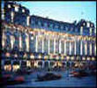
Address: The Aldwych, London, England, UK, WC2B 4DD

Hold down your left mouse button down while clicking on the map, keep it held down to move the map around. Use the + and - symbols on the maps left bar to zoom in and out.. Click an icon to view hotel information

>>>BACK TO WALDORF HILTON HOTEL - LONDON PAGE

SHOW NEXT NEAREST HOTELS:  1-10:  11-20:   21-30:   31-40:   41-50:    


Directions:
Covent Garden underground station (Piccadilly line, with direct connection to Heathrow Airport) is 5-minute walk away. Holborn underground station (Piccadilly and Central lines) and Temple underground station (Circle and District lines) are both reachable with a 10-minute walk.

A number of local bus routes, as well as sightseeing tours, can be accessed from the stops next to the hotel.

>>>BACK TO WALDORF HILTON HOTEL - LONDON PAGE

Privacy Policy
Copyright © 2021 Milesfaster.co.uk All Rights Reserved