From Central London: 1.1 miles (1.8 km)
nearest
Tube Station: Russell Square 0.2 miles (0.3 km)
Railway Station: London St Pancras Domestic 0.4 miles (0.6 km)
Motorway: M1 Junction 1, 5.5 miles (8.8 km)
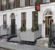
Address: 20-24 Tavistock Place, WC1H 9R, London, UK
Hold down your left mouse button down while clicking on the map, keep it held down to move the map around.
Use the + and - symbols on the maps left bar to zoom in and out..
Click an icon to view hotel information
Russell Square: Cross Bernard Street by the pedestrian crossing, walk straight up Marchmont Street directly opposite and continue for two blocks. Turn left on to Tavistock Place and hotel is on the left. Journey time: 3mins
Euston: Pass the bus station, cross the park in front of the station, walk down Upper Woburn Place, at Tavistock Place turn left and hotel is on the right-hand side. 5mins
Kings Cross St. Pancras: Walk up Euston Rd (towards Euston Station). Turn left into Judd St. and then right into Tavistock Place, hotel is on the left-hand side. 8mins
Liverpool St Station: take Central line to Holborn, change onto the Piccadilly line and it is then 1 stop to Russell Square. 25mins.
Victoria Station: take Victoria Line to Euston station and walk from there. 20mins. Please note that Victoria bus/coach station is a 5 minute walk from the train station.
 From Central London: 1.1 miles (1.8 km)