159 Knightsbridge Hotel map


159 Knightsbridge Hotel From Central London: 1.3 miles (2.1 km)
nearest
Tube Station: Knightsbridge 0.1 miles (0.2 km)
Railway Station: London Victoria 0.9 miles (1.4 km)
Motorway: M4 Junction 1, 5.0 miles (8.1 km)

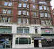
Address: 159 Knightsbridge, London, England, UK, SW1X 7PD

Hold down your left mouse button down while clicking on the map, keep it held down to move the map around. Use the + and - symbols on the maps left bar to zoom in and out.. Click an icon to view hotel information

>>>BACK TO 159 KNIGHTSBRIDGE HOTEL PAGE

SHOW NEXT NEAREST HOTELS:  1-10:  11-20:   21-30:   31-40:   41-50:    


Directions:
From Heathrow Airport:
- Take the Heathrow Express to Paddington then a taxi to the hotel.
- Or take the Piccadilly underground line; the hotel is only a 2 minute walk from the Knightsbridge Underground station.

From Gatwick Airport:
- Take the Gatwick Express to Victoria Station then a taxi to the hotel.
- Alternatively, the Number 52, 9 and 10 buses stop right outside the door of the hotel.

>>>BACK TO 159 KNIGHTSBRIDGE HOTEL PAGE

Privacy Policy
Copyright © 2021 Milesfaster.co.uk All Rights Reserved