Travelodge Docklands map


Travelodge Docklands From Central London: 5.7 miles (9.2 km)
nearest
Tube Station: North Greenwich 0.8 miles (1.4 km)
Railway Station: West Ham 1.2 miles (1.9 km)
DLR Station: East India 0.2 miles (0.3 km)
Motorway: M11 Junction 4, 6.0 miles (9.6 km)

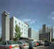
Address: Coriander Avenue, East India Dock Road, London, UK, E14 2AA

Hold down your left mouse button down while clicking on the map, keep it held down to move the map around. Use the + and - symbols on the maps left bar to zoom in and out.. Click an icon to view hotel information

>>>BACK TO TRAVELODGE DOCKLANDS PAGE

SHOW NEXT NEAREST HOTELS:  1-10:  11-20:   21-30:   31-40:   41-50:    


Directions:
Exit M25 to A2, head towards Blackwall Tunnel. Take A102 through tunnel, follow A13 (Barking). Turn right at traffic lights signposted Isle of Dogs/ City Airport. At next roundabout take 4th exit to Saffron Avenue. Bear left on the mini-roundabout and ask for Travelodge at the security gates. Take 1st right and Travelodge is ahead of you.

>>>BACK TO TRAVELODGE DOCKLANDS PAGE

Privacy Policy
Copyright © 2021 Milesfaster.co.uk All Rights Reserved